Gobi Desert, Mongolia
The Gobi is one of the greatest deserts in the world. A stripe stretching for more than 1,500 kilometres from the Northern part of China to South-Eastern Mongolia occupies the territory bigger than UK, France, Spain and Portugal taken all together — 1,3 million square kilometres.
The Mongolian word "Govi" means "Waterless Place", but the Gobi is not only the desert — its terrain is rather diverse. High dunes of drifting sands cover only 3% of the Gobi territory. The main part of its lands is occupied by broad stony and clay valleys, huge prairies, picturesque rocky mountains, vast basins with rare oases, hillocky areas, salt marshes, canyons... The climate of the Gobi is sharply continental. Cross-seasonal temperature variations are extreme and can be compared to the ones of the "Pole of Cold" in Oymyakon, Yakutia. The winter is rather cold (up to -50℃) with strong gusts of wind and the summer is extremely hot (up to +55℃).
Local people are very friendly and curious, always ready to talk and help in any situation. At the same time, practically all of them — including those living in the capital, Ulan-Bator — do not speak any foreign language, neither English, nor Russian. That's why we had learnt some Mongolian words which made our life a little bit easier: "Sain baina uu" — "Hello", "Bayartai" — "Goodbye", "Bayarlalaa" — "Thank you", "Zügeer ee" — "You are welcome", "Sain" — "Good".

A couple of words about local food: such a notion as "fast food" (in its direct meaning) can be met only in big cities. As for smaller towns and villages, in zoogiin gazars (cafes) and cajny gazars (canteens) cooking takes some time: the meat will be cut, the soup will be boiled and manti will be created right at your presence. Everything is delicious and fresh, but be ready to spend an hour and a half to have a meal.
The way to the desert was a difficult and long one. It took us more than a week to leave Novosibirsk and get the first destination of our expedition — Khermen Tsav, via Chuya highway, climbing the passes and crossing the wades.
In deserts the roads are regarded as "directions". Indeed, if you have a navigator, why should you follow someone's path in case any other way is as hard as this one?

And one more "navigational" feature: there are no postal addresses in Mongolia, for delivering they use geographical coordinates — longitude and latitude.
In Mongolia travelling on one car is rather unsafe: in case of any smallest breakage or failure you are risking to be left without any help. As for the expedition to some remote and rough terrain regions it is recommended to have at least three well-equipped off-road vehicles.
At the beginning of the canyon you can't help noticing a huge branchy "Tugrik tree" where travellers leave small "donations" — 100, 200 or 500 Tugriks. Thick bushes of saxaul begin to appear in sight. You should be very careful with it: saxaul is rather sharp, and it can easily cut the tires of our cars.

It was not an easy thing to find a proper approach to the canyon — one time we rested on a wall, the other we found ourselves on the edge of a cliff. Once we even had to climb a high sand dune steering wheel in the most unimaginable way.
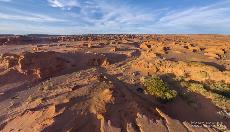
A 20-kilometers long canyon named Khernem Tsav (translates as "Sharp Rocks"), with steep red cliffs made of sandstone, stuns with its monumental beauty and resembles the famous Grand Canyon in Colorado, in some way. Like in Rorschach pictures, everyone can see their own figures in the "architecture" of the canyon: it can be either Buddha stupas, or Christian churches, and both monumental fortified walls and ancient eastern ensembles. One of the eroded "sculptures" has gotten the name "Sphinx".

While we were staying in a camp in the canyon, suddenly a sandstorm began and the wind began blowing away our tents. It felt like this red fine sand wanted to penetrate everything it could: cups, zipped tents, camera lenses. As soon as we saw this, we hid in the cars to wait till it was over. The realisation of this "sitting and waiting" was rather frustrating: at such a wind we failed not only to launch our drone, but even taking out the cameras was a big problem as well. Six hours later just before the nightfall, a miracle happened — the storm ceased and we finally managed to launch the drone to make several panoramas.
They show the abode of the ancient fossil animals. The point is that the Gobi is also famous for having numerous fossilized dinosaur finds. In 1925 the expedition of the American Museum of Natural History found in Bayan Zag sandstone area a lot of dinosaur remnants and even multiple dinosaur fossilized eggs. In 1946 the Soviet expedition of the Academy of Sciences under guidance of professor Yefremov found the crucial location of gigantic dinosaur fossils in Nemegt — the largest one in the Old World. Around 80 skeletons of 60 species were found in Mongolia — a quarter of the overall number of dinosaur finds in the world.

We were photographing at the estuary of Khermen Tsav. At the Cretaceous this place was inhabited by a huge number of triceratopses — four-legged herbivorous dinosaurs. Their fossils can still be found in these lands.
Just before our departure from Khermen Tsav I was "lucky" enough to have gotten lost. For more than an hour I was wandering in the labyrinths and passes of the canyon. My imagination started creating the visions of how I can become a fossil myself because this place is rarely visited even by the Mongols. I had to follow my own footprints to find the way out. Thanks to the absence of wind, I could easily find them.

Our next destination was one of the most picturesque sights of the Gobi — Khongoryn Els, also known as the "Singing Sands". A huge stripe of sand dunes stretching for over 180 kilometres and having the height up to 300 meters and the width between 3 and 15 kilometres.
At the look at Khongoryn Els you have a feeling that a huge machine brought a great amount of sand here and placed it carefully in the middle of the stony desert, so artificially it looks. A perfect place for those who did not spend enough time in a sandbox in their childhood. As for me, I wish I had a snowboard with me — the steep slopes of dunes are just perfect for sliding.
In the twilight the majestic waves of sand dunes look unusually prominent. This is the world where the lines are exact, they divide the dark and the bright side from each other. But if you want, you can walk on the ridge and break this line and the ridge will form another outline which will be as distinct, as the previous one.

Our final destination in our expedition was the sandy cliffs of Bayan Zag (literary "Rich in Saxaul"). They are also often referred as "Flaming Cliffs" due to the red and orange colour of the sandstone cliffs. Comparing to Khermen Tsav and Khongoryn Els, this place is rather easily accessible from the nearest settlement Dalanzadgad — "The capital of the Gobi"; it takes only several hours to get there from this city.
The wind erodes the layers of multi-coloured sandstone and pressed clay, and during the rains the water washes them out. Without occasional bushes and grass it would look like a truly Martian landscape.

As we have mentioned, in the 1940s a big paleontological expedition under the guidance of the great palaeontologist and science fiction author Ivan Yefremov was studying these lands. This is how he described this place: "But still, in the evening, at least ten minutes before sunset, the canyon revealed the best incomparable fantastic scene. The eroded cliffs of the ancient sandstone formations were blazing with the bright red colours. It felt like the whole basin was on fire. And this phenomenon can be easily explained: the rays of the setting sun were illuminating the red walls of the basin and sarsen sandstones, creating a rather realistic vision of the "burning cliffs". Probably, these "alien" landscapes inspired this science-fiction writer to create his novel "Andromeda Nebula", didn't it? And now you also have an opportunity to travel to these "extra-terrestrial", but still earthy lands, with the help of our panoramas.
Photos and text by Maxim Nasekin
7 July 2016
Read more
Photogallery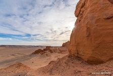 In the Hermen Tsav
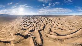 Hongoryn Els
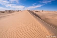 Khongoryn Els sand dunes
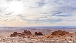 In the Gobi desert
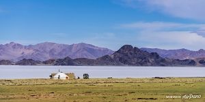 Tolbo Nuur Lake
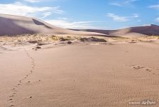 Hongoryn Els
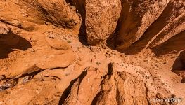 Flaming Cliffs Bayanzag
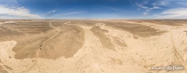 On the way to Hermen Tsav
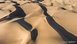 Hongoryn Els
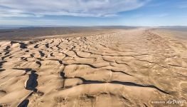 Hongoryn Els ("Singing Sands")
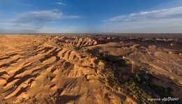 Hermen Tsav
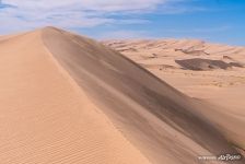 Hongoryn Els ("Singing Sands")







Virtual Travels in 360°
 Delta of the Orinoco River, Venezuela
 Trip to Raja Ampat archipelago, Indonesia
 Antarctica, South Georgia Island
 North Goa, India. Part I
 Night Shanghai, China
 Dunhuang Yardang National Geopark, China
 Manpupuner Rock Formations, Relaxing Video
 New Jerusalem Monastery, Russia
Show more


